Maps
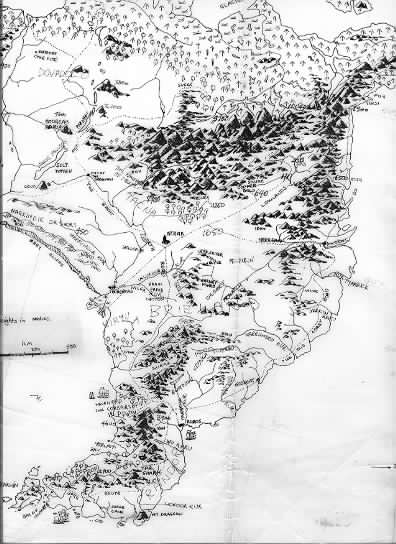
All the maps were hand drawn by Ian, based on door-sized maps created during his world-building phase of the late 1970’s and early 80’s. Part of one of the earliest maps is shown below (1978).

The final map of Lauralin and Meldorin (first in the gallery below), was redrawn at A4 size from an original approximately 2 metres high by 1 metre wide. The map is extensively modified from the original, including redrawing in reverse. The maps were lettered by Cathy Larsen.
The Three Worlds
Below the gallery, you’ll find more information about which books reference which maps.
The following maps are used in The View from the Mirror.
- South Santhenar
- Meldorin Island
- North-Eastern Meldorin
- Iagador
- The Dry Sea
The Well of Echoes refers to:
- South Santhenar
- Mirrilladell
- Western Lauralin
- The Dry Sea
In The Song of the Tears, this map is used.
- South Santhenar
All these maps were drawn by the author and lettered by Cathy Larsen at Penguin Books.
Runcible Jones
A sketch map of part of Iltior, for the Runcible Jones books, Runcie Map, and the published version (by Cathy Larsen), Runcible 3 Map:
Grim and Grimmer
Wychwold is the map used in the Grim and Grimmer books, drawn by Patricia Howes based on a sketch by Ian Irvine.
Plan of the Wychwold Scale Model, third floor of the Fey Queen’s Winter palace, scene of the battle in The Calamitous Queen. Map by Patricia Howes.
The Tainted Realm
A very rough map (Rough Map, Cythe) that forms the basis of the final map in Vengeance – Central Hightspall (Vengeance) – which shows the volcanic province of Central Hightspall, known as Cythe in olden times. From Rebellion, the revised map for Central Hightspall and Greater Hightspall.


